Mediterranean tragedies are the result of heatwaves
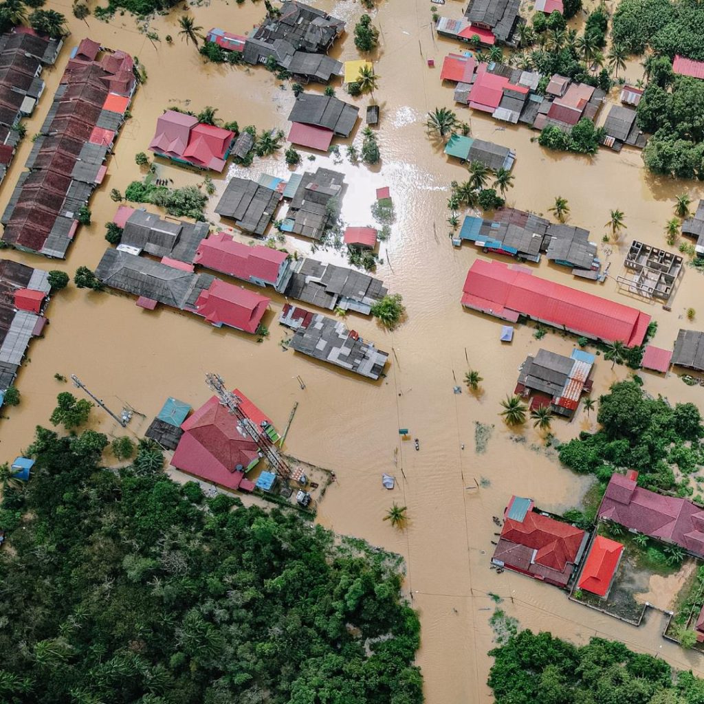
The video footage from Libya is shocking. The number of dead is unimaginable. And so is the suffering associated with it. Experts say that the heavy rainfall events, which also hit other Mediterranean countries such as Greece, Bulgaria and Turkey hard and brought the amount of rain that normally falls in half a year within a few hours, were a consequence of this summer's heatwaves. Storm Daniel, which raged in the eastern Mediterranean, turned into a so-called Mediterranean hurricane, or Medicane for short, and drew its energy from the particularly warm Mediterranean Sea. But not only here, similar scenes are currently unfolding in many parts of the world: Spain, Hong Kong, California, Brazil.
In an interview with riffreporter, ZDF meteorologist Özden Terli said that storms were predictable after the extreme heatwaves in the Mediterranean. In Greece, up to 1,000 liters per square meter fell within a few days in some places, and up to 700 liters in others, on the barren, parched ground, turning the landscape into huge lakes and raging rivers. In Hong Kong, 156 liters per square meter poured down in just one hour. For comparison: 500 to 700 liters is the annual amount in this country.
You can't really prepare for that. You can only leave the area and flee.
ZDF meteorologist Özden Terli
We don't know whether there was a timely warning in Greece. In Libya, people were surprised by the masses of water that burst two dams and flooded the city of Derna several meters high. As the ground was unable to absorb these masses in such a short time, it collected in the river basins and poured onto the plains.
Last week, we measured rainfall that has never been seen before in Europe. In some cases, it was many times more than what we had here during the Ahr valley flood.
https://news.pro.earth/2023/05/03/wissenschafter-alarmiert-ueber-rasche-weltmeererwaermung-vor-el-nino/
It was clearly foreseeable
Will this become the norm?
"Climate change doesn't just mean higher temperatures, but above all means more extreme weather, more potential for damage and, above all, a huge challenge for people in terms of health," explains Latif, adding that people can adapt to a certain extent. But there are also limits: "With such masses of water, what else do you want to do?"